


Trollsteinen is a mountain with a strange rock on top that looks like a troll, just a few kilometres from the northernmost town in the world, Longyearbyen. As with most activities in Svalbard, you have to go with an organized trek, unless you want to rent a gun, which is rather expensive. Due to the permanent threat of polar bears, leaving the settlement unarmed is not allowed – and it’s stupid.
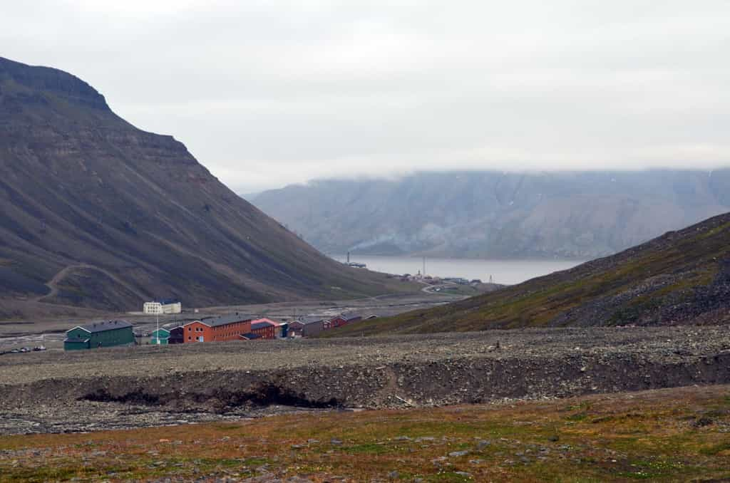
We left from Nybyen, a “suburb” of Longyearbyen, just 2 km away. This apparently useless separation dates back to the old days, when mining company and government administrators wanted to keep a certain segregation between the workers and themselves and their families.

Longyearbyen is surrounded by incredible walls of mountain cliffs.

Our guide Alex the geology student (packing the rifle), helps his dog cross a rather intense stream of melted glacier water.

The geography is incredibly dynamic. A few days ago, everything was uniform like in the top of the picture, but suddenly, water began gushing out of the ground and took away countless tons of soil down the hill.

The Lars glacier. Not too difficult to cross in the summer, but crossing a glacier always has an element of risk. Our goal, Trollsteinen, can be seen in the distance. It is the small bump on top of the mountain in the background.

Water doesn’t always flow on it, it can flow under, then gush back on the surface and underground again. I realize there is no size reference in this picture, but the hole is more than big enough to fall into. And the “bridge” of snow covering it can be thick enough to block the sound of water, but too thin to support your weight. Beyond getting wet, falling in a crack can mean a drop of unknown height and getting someone out alive is far from certain. Another good reason to go with a guide.

Sediments fall on the ice and, being dark, absorb the heat from the sun, melting the ice. Once a few centimetres deep, they become protected from the sun and cool, allowing the water to freeze again over them. These kind of phenomena are produced all over the glacier on a gigantic scale, resulting in the strange geography of areas where glaciers are present.

Trollsteinen reflected in the water.

Lars Hiertafjellet, a nearby mountain of similar elevation (878 m).
A girl from Oslo asked me why I was going to Svalbard. I said the scenery looked incredible, with all the barren landscape of mountains and valleys, almost completely devoid of plant life. “So you’re going all the way there to watch plants not grow?” She answered. Well, maybe a little, but I did find some flowers!

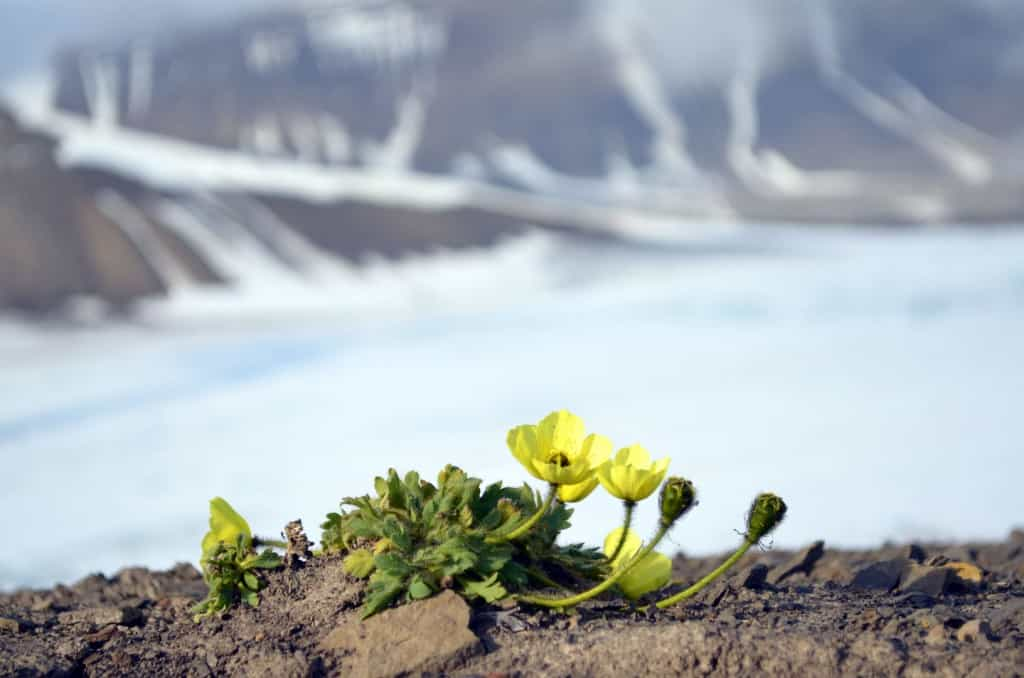
Tough little flowers, for sure.

Longyearbyen, seen from the glacier.


Not the narrowest ledge, but it’s a good idea not to fall off.
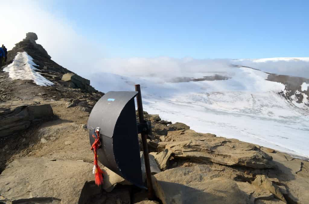
On the final stretch, we see what? A mailbox? Actually, locals who climb it and other nearby mountains can leave their name and contact information. Once in a while, whomever is in charge of these areas collects all the cards and draws some prizes!
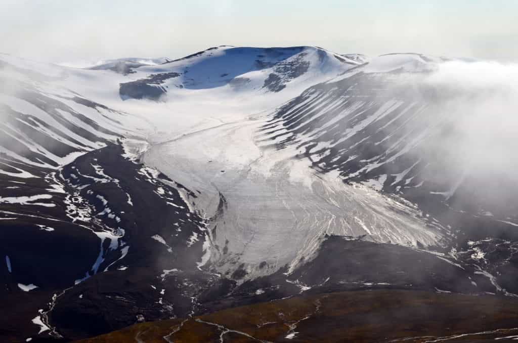
Another glacier in the valley beyond. In the early days of the settlement, I think creativity was not the most important value. The first three valleys beyond Longyearbyen bear the following poetic names: “First valley”, “Second valley” and “Third valley”.

A snow zebra.

And the summit. Far behind, to my right, Longyearbyen, and just behind me on the left, Trollsteinen. In total, a hike of about 6 or 7 hours, going slowly and stopping for lunch at the summit.
This was my last post from Svalbard. Next time: Oslo, the most expensive city I ever visited!
#Norway